
Advanced Technology for Mapping and Topography
We work with leading brands worldwide in the Mapping, Aerial Photogrammetry and Terrestrial Topography fields. By using this advanced and unprecedented technology, we rapidly develop projects and works which traditionally would be more expensive and impossible to undertake in the deadlines which we are able to offer. In far less time and therefore greater profitability for the customer.
MAPPING AND AERIAL PHOTOGRAMMETRY
With GEODRON’s fixed wing and rotary wing unmanned aerial vehicles (UAV or commonly known as a drone), new standards in precision, robustness and performance mapping by capturing aerial images as accurate medium for obtaining data for topographic works and Geospatial information are set.
Equipped with RTK (Real Time Kinematic), Geodron’s new UAVs can allocate more hectares per flight than any unmanned aerial vehicle in its weight class. Flying at a permissible height of 120 metres over the ground and a duration of over 1 hour of flight, the coverage of the acquired land is 220 has, with a GSD (ground sample distance) of 1cm/pixel, which corresponds to a precision in xyz of 3cm.

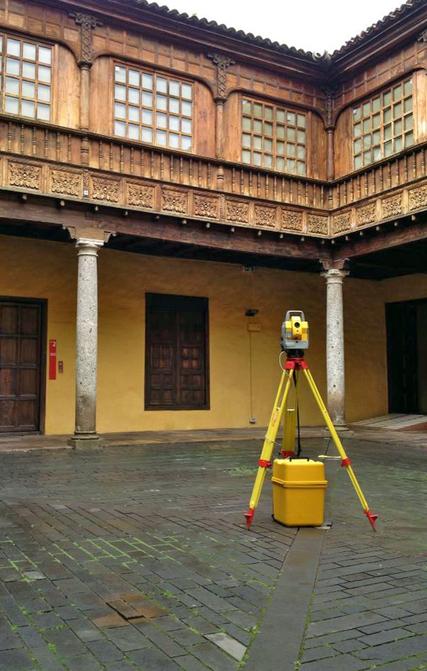
CLASSICAL TOPOGRAPHY
In order to provide a comprehensive service and using latest generation equipment, GEODRON has Topography Engineers who provide professional coverage to any traditional topographic work with high solvency and superior quality, advising and offering an overall assistance to different professionals as regards Construction, Administration, Studies, Companies and Individuals.
- Adjustment of stakeout base networks
- Project sections and tunings
- Readiness for construction certificates
- Monitoring: Dams, Viaducts, Structures
- Stakeout (layout) of structures
- Stakeouts (layouts) of linear works
- Levelling
- Photogrammetric media with GPS
- Execution and control of works: Civil – Viaducts, Roads, Railway Lines, Tunnels… Hydraulics – Dams, Pipelines, Reservoirs, Supply Tanks… Industrial – Power and Communication Lines, Wind Farms, Power Plants, Refineries, Gas Pipelines… Residential estates
- Measurement control
- Topographical surveys for projects (in 3D, architectural …)
- Final site drawings
- Drawing up of technical and expert reports for procedures and submissions (cadastral, property register, town halls…)
- Division of estates
- Segregation and grouping of plots of land projects
- Property identification and location
- Surveys and boundary markings
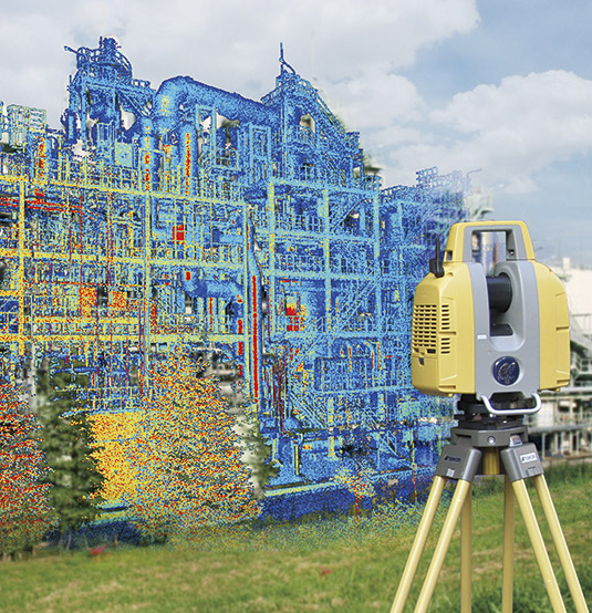
LASER SCANNER
This technology allows us to create 3D models with millimetric accuracy and whose application range is unlimited. The product which is created is a point cloud of very high intensity from which we can perform metric calculations, 3D and 2D element modelling, and obtain drawings, sections, topographic calculations…
Fields of action
Topographic, mining and underground surveying, dams, roads (roads, slopes, structures…), viaducts and engineering structures, architecture and construction works, power lines and electrical substations, industrial plants (Gas refineries, oil refineries…), facilities (automotive, aeronautics…), shipbuilding, pipelines, maritime platforms, proprietary documentation and monitoring (architectural, archaeological, works of art…), forensic studies, military environments…
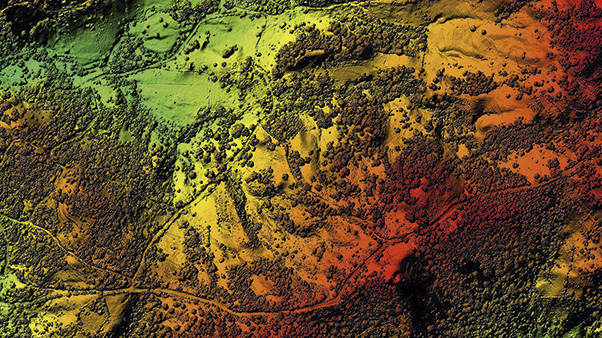
LIDAR
To obtain highly accurate maps and resolution GEODRON has LIDAR technology, this being a reference benchmark for engineers, ecologists, habitat managers and those financial investment institutions in the field of energy, offering essential information and solutions to obtain maximum yields out of each project.
MOBILE MAPPING
It is the clear commitment to a technology which offers an infinite number of applications and new uses in different areas, from the planning and management of public roads based on detailed knowledge of street furniture, property, lighting, pavements, green spaces, design mobility plans and accessibility studies for emergency and civil protection teams, optimised management of services of all these applications used for photographing and scanning in 360º a road from a vehicle obtaining the images and data necessary to convert millions of points into deliverable products which can be used in Engineering, Surveying, Urban Mapping, inventories…

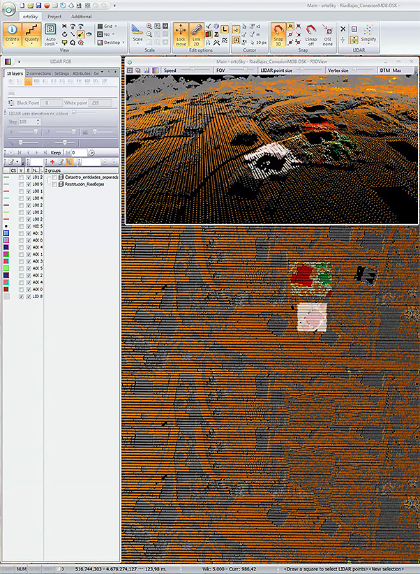
SOFTWARE
Geodron uses professional specialised software for the production and processing of geographic information, using the most advanced 3D stereoscopic processing and viewing technologies on the market which offer the following advantages:
- Integrates in a single tool functionalities which were traditionally carried out using different analysis or production software in the same project (LiDAR – stereo return, debugging and classification, altimetric product generation, 2D digitalisation, geoprocesses, raster image analysis, execution of free software command line utilities, export to different formats, complete management of photogrammetric flights, including aerial triangulation, 3D point cloud generation by image correlation, orthophotography, etc.
- Integrated management of all data sources in a single system (LiDAR, stereoscopic pairs, MDE, orthophotography, WMS etc.)
- 3D capture of information on GIS data models, either by stereoscopy or by the capture of heights from LiDAR, supporting multiple formats and projection systems.
Applications: from cartographic generation and production, to quality control or integrated exploitation together with other multiple purpose systems, such as GIS, augmented reality solutions, emergency systems, coastal and flood-prone areas management, etc.