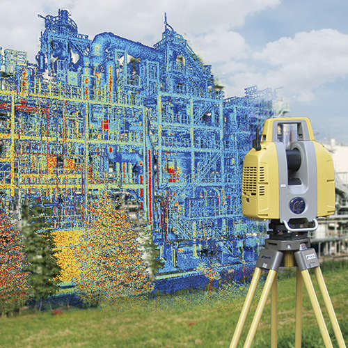
This technology allows us to create 3D models with millimetric accuracy and whose application range is unlimited. The product which is created is a point cloud of very high intensity from which we can perform metric calculations, 3D and 2D element modelling, and obtain drawings, sections, topographic calculations…
Laser Scanner Applications
- Topographic
- Mining and underground surveying
- Dams
- Roads (roads, slopes, structures…)
- Viaducts and engineering structures
- Architecture and construction works
- Power lines and electrical substations
- Industrial plants (Gas refineries, oil refineries…)
- Facilities (automotive, aeronautics…)
- Shipbuilding
- Pipelines
- Maritime platforms
- Proprietary documentation and monitoring (architectural, archaeological, works of art…)
- Forensic studies
- Military environments…

