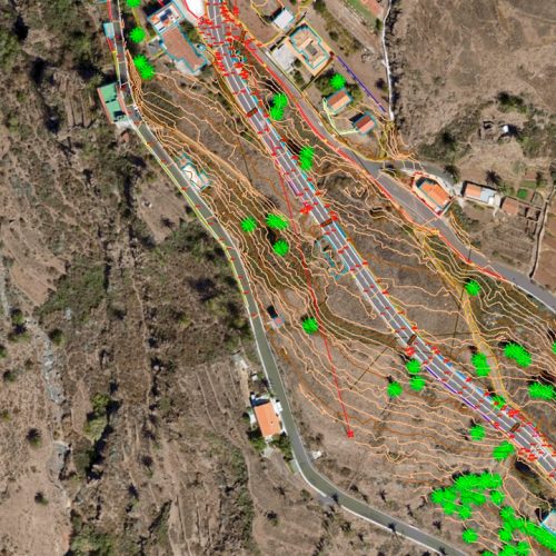
Our technicians are extremely versatile specialists using this technology for accurate and detailed representation of any infrastructure: roads, railways, power lines … likewise making maps of very vast, inaccessible and complex areas.
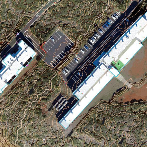
Aerial photogrammetry allows us to obtain Digital Terrain Models and Orthophotos with a high level of detail, as if they are plans and maps which allow for making precise measurements.


Classic Topography, Aerial Photography, Laser Scanner and Mobile Mapping
In order to provide a comprehensive service and using latest generation equipment, GEODRON has Topography Engineers who provide professional coverage to any traditional topographic work with high solvency and superior quality, advising and offering an overall assistance to different professionals as regards Construction, Administration, Studies, Companies and Individuals.
- Adjustment of stakeout base networks
- Project sections and tunings
- Readiness for construction certificates
- Monitoring: Dams, Viaducts, Structures
- Stakeout (layout) of structures
- Stakeouts (layouts) of linear works
- Levelling
- Photogrammetric media with GPS
- Execution and control of works: Civil – Viaducts, Roads, Railway Lines, Tunnels… Hydraulics – Dams, Pipelines, Reservoirs, Supply Tanks… Industrial – Power and Communication Lines, Wind Farms, Power Plants, Refineries, Gas Pipelines… Residential estates
- Measurement control
- Topographical surveys for projects (in 3D, architectural …)
- Final site drawings
- Drawing up of technical and expert reports for procedures and submissions (cadastral, property register, town halls…)
- Division of estates
- Segregation and grouping of plots of land projects
- Property identification and location
- Surveys and boundary markings
Projects of Topography and Civil Works