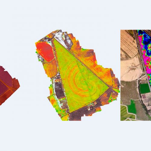
Data obtained through the GEODRON’s unmanned craft (UAVs) are used in different environmental aspects. The Geographic Information System (GIS) would be based on those aspects allowing a better planning of the maintenance and control services of the companies that carry out work in the various areas of action, developing programmes and using the photographic documentation for each action in particular.
“GEODRON is aware of the importance of protecting our natural resources and facilitating human development in a sustainable manner.”
Drones for territorial management
The technology used by GEODRON facilitates the work of public administrations, architecture studies or companies working in territorial management studies helping them both in forest as well as landscape areas.

Environmental Projects