Photogrammetric flight with near infrared (NIR) camera – Corn Crop, Huesca
Title
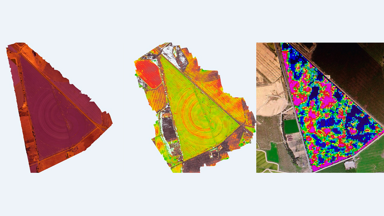
Corn crop. Photogrammetric flight with near infrared (NIR) camera over a corn field. Los Monegros, Huesca.
Company
Particular
Category
Precision farming and EnvironmentAbout This Project
Photogrammetric flight with fixed wing unmanned aerial vehicle (UAV) with near infrared (NIR) camera to study the evolution of a 42 hectare corn field. Obtaining the normalised difference vegetation index (NDVI).